Ron Vickers
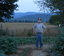
 This is a photo of me. It was taken when a group of professionals were planning the pilot course, Geospatial Technologies. With lots of assistance from a community volunteer, RCHS members were able to enter the Geospatial contest last spring. Each superintendent's district was included in the piloting of this exciting new course. A couple of other schools bought into the ArcGis software to enable 13 different schools to offer the course to students. It is my understanding that a statewide license is in the works for every school division in the state. This means students throughout the state may get the chance to learn about these technologies. ...... Since this is my first postiong of a photo in the blog, I had not planned out what to include . .... Keep checking back to learn of local RCHS TSA news. I will try to post meeting agendas, opportunities to use the school labs after school, announcements, and celebrating student successes.
posted by Mr. Ron Vickers at 10/13/2005 07:05:00 PM
![]()

<< Home